A viewshed for radio: LOS vs RF
Waveshed has two modes, and they answer two genuinely different questions. LOS (line of sight) is a viewshed: it tells you what is visible from a point. RF tells you where a transmitter’s signal actually reaches, and how strong it is. On the map they can look alike. They are not the same thing, and picking the right one changes the answer.
Same hilltop, two questions
Here is one transmitter on Mount Rigi, run twice with everything else held fixed: a 30 m mast, a 2 m receiver, 30 km range, full circle. The only thing that changed between these two maps is the question being asked.
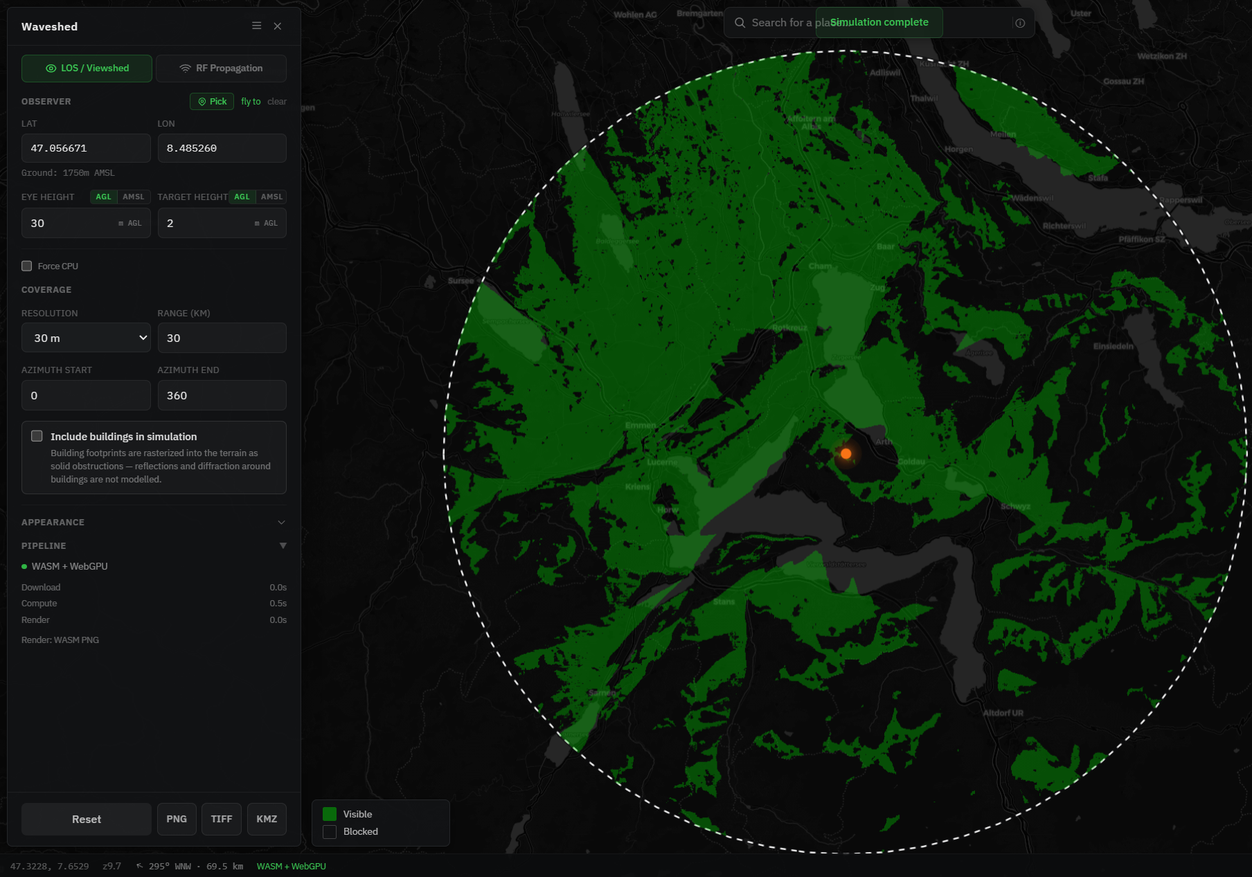
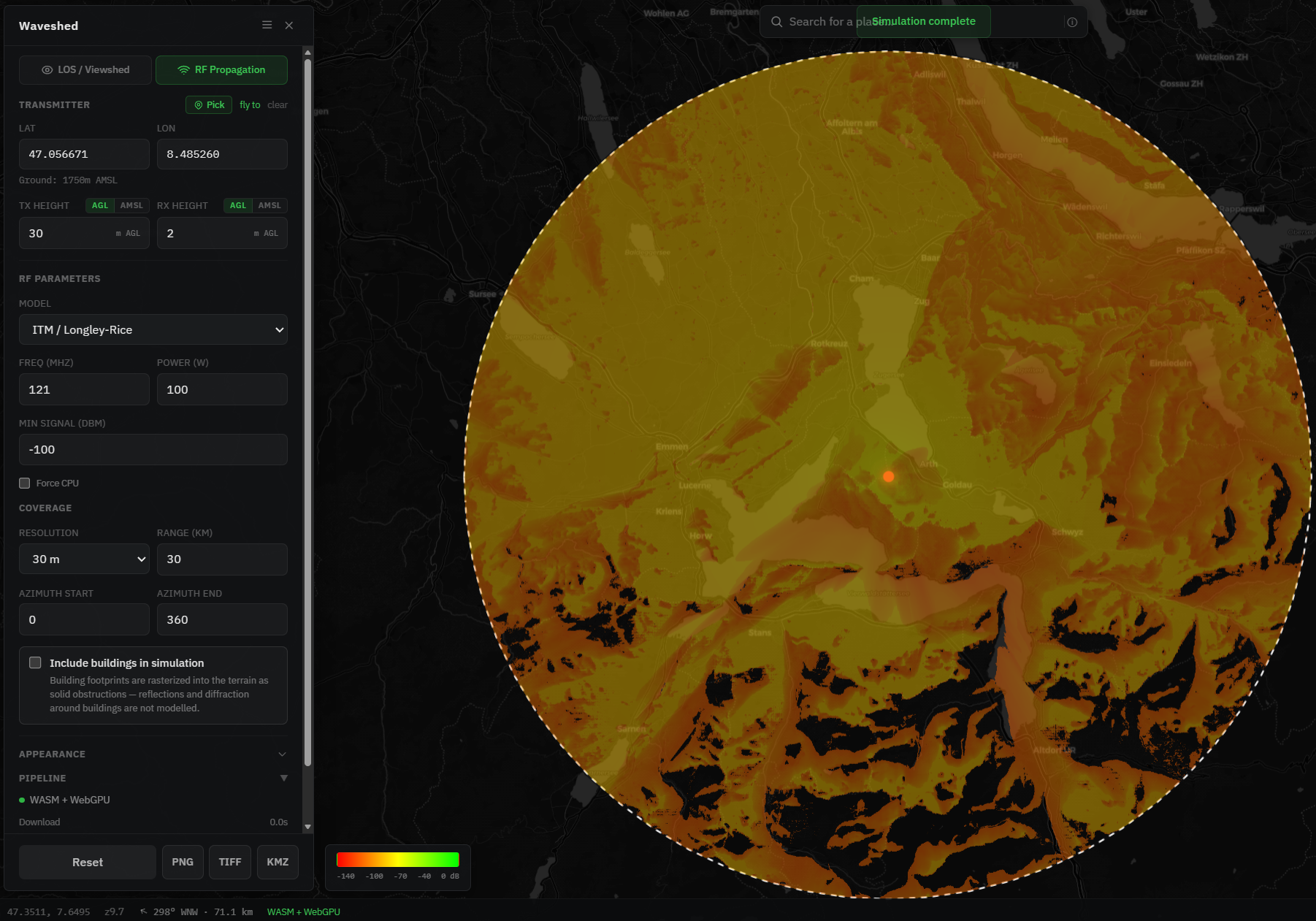
Two things jump out. The RF map is graded where the LOS map is binary, and the RF map fills in more ground with softer edges. That is not noise. Radio diffracts over and around ridges, so it seeps into terrain the strict sight line never touches, and it fades with distance rather than stopping at a hard line. The rest of this post is about why, and which map you actually want.
LOS: pure geometry
A viewshed is geometry and nothing else. From your observer, is there an unobstructed straight sight line to each point, given the terrain and the curve of the Earth? If yes, that point is in your viewshed. Three things follow from that simplicity:
- It is fast, because it is one geometric test per point.
- It is frequency-independent. A viewshed does not care whether you are on 100 MHz or 10 GHz, because it is about sight, not signal.
- It needs no power and no frequency. "What can I see from this summit?" is a complete question on its own.
That makes LOS the right tool for vantage points, optical and laser links, microwave dish aiming, and a quick "can these two spots see each other" check. It is also the honest answer for hikers, surveyors and photographers, who are asking a visibility question, not a radio one.
RF: terrain physics, in dBm
RF mode estimates path loss to predict received signal strength, and the working model is ITM, the Irregular Terrain Model, better known as Longley-Rice. ITM has been the standard for terrain-limited coverage for decades. Instead of a yes or no, it accounts for diffraction over and around terrain and returns a number, a predicted signal level in dBm, for every point on the grid. That is exactly why the RF map above is graded, and why it shows coverage in places that are not in strict optical line of sight.
To run it you supply two things a viewshed never needs: a frequency and a transmit power. You also set antenna heights and a minimum usable signal level, the cutoff that decides where the map goes dark (the black areas in the Rigi map are below it). A simpler distance-and-frequency-only estimate, Free Space Path Loss, is on the way as a second RF model. For a walkthrough of the settings, see Plan radio coverage.
Frequency changes the picture
Frequency is the one RF setting with no equivalent in a viewshed, and it moves the answer a lot. Two effects dominate. First, path loss rises with frequency: even in open air a higher band loses more energy over the same distance, so for the same power and the same terrain it simply does not reach as far (free-space loss climbs about 6 dB every time you double the frequency). Second, higher frequencies diffract less. Low frequencies bend over and around ridges and fill in shadows, while high frequencies behave more like light, casting harder, sharper shadows, and their Fresnel zone is smaller, so they need a cleaner path.
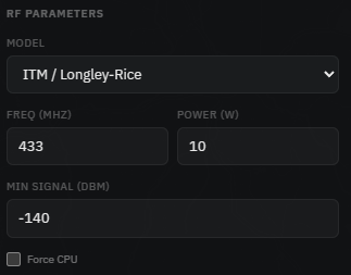
So the same transmitter draws a very different map depending on the band. Here is Mount Rigi again, same 100 W and the same heights and range, at 121 MHz (VHF) and at 9 GHz (microwave):
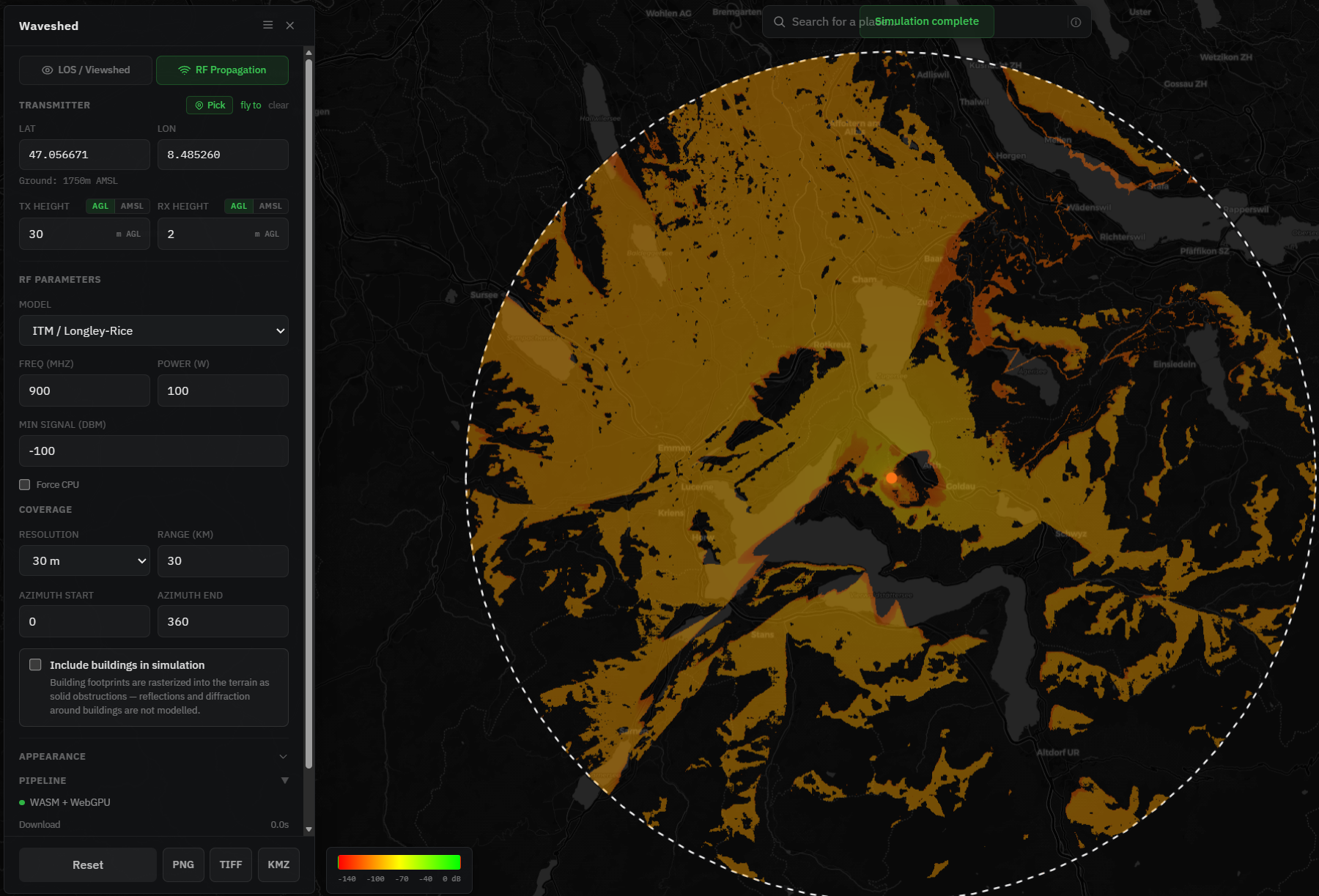
At 9 GHz the signal reaches roughly line of sight and little further, which is exactly why point-to-point microwave links demand a clear path, and why VHF and UHF are the workhorses for terrain-limited coverage like repeaters and handhelds. Run the band your real system uses, because it changes the map.
The horizon is not where you think
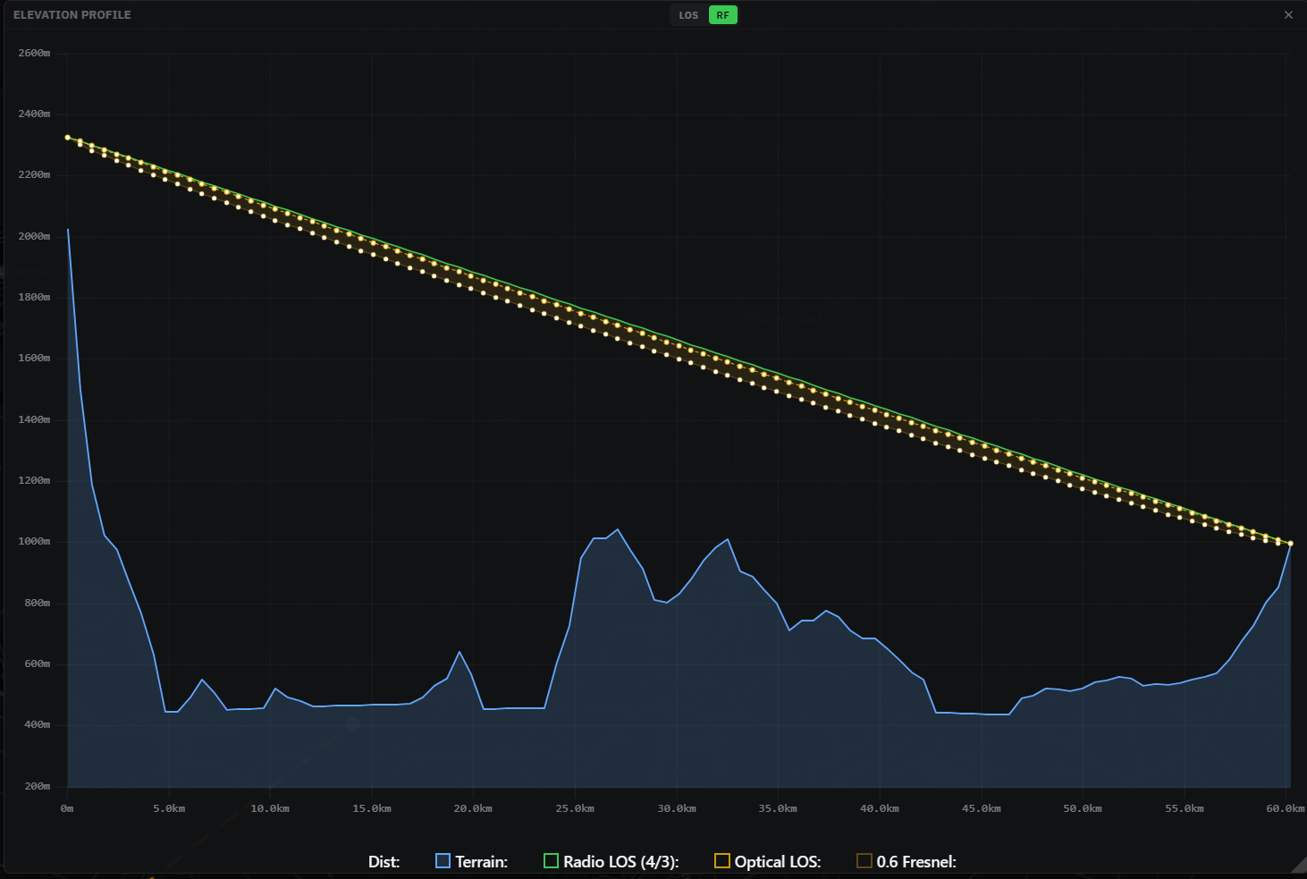
Light and radio do not share a horizon. The atmosphere refracts radio slightly downward, so its effective horizon sits a little beyond the optical one. The usual way to model that is the 4/3 effective-earth radius. In the elevation-profile tool you can see both at once: the optical ray on the true earth, and the radio ray on the 4/3 earth reaching a touch further.
There is a second thing radio cares about and sight does not: the Fresnel zone. A radio link wants more than a bare sight line, it wants clearance around that line. The rule of thumb is to keep the first Fresnel zone at least 60 percent clear (the first Fresnel radius is F1 = 547.7 × √(d1·d2 / (f·D)), with distances in km and frequency in MHz). The profile tool shades that 0.6 Fresnel envelope, so it flags an obstruction that a bare LOS check would wave through.
So which do you use?
The short version: LOS answers visibility, RF answers coverage. If a frequency matters to your question, you want RF.
Reach for LOS when
- You are asking "what can I see from here?"
- You are siting a vantage point, or planning a photo or hike.
- You are aiming an optical, laser or microwave line (then check Fresnel in the profile).
- You want a fast, frequency-free sanity check that two points are inter-visible.
Reach for RF (ITM) when
- You are asking "where will my radio actually be heard?"
- You are planning repeater, simplex or broadcast coverage.
- You are comparing mast sites by signal, not just sight.
- You are checking a WISP subscriber or an FPV / drone link over terrain.
What neither mode knows
Both modes run on global terrain data of roughly 30 m, and both model the ground, not the clutter sitting on it. Individual trees, foliage and most buildings are not represented (building footprints can be rasterized in as solid blocks, but reflections and diffraction around them are not modelled). Antennas are treated as simple points without gain patterns. So treat every result as a planning estimate rather than a guarantee, and ground-truth the marginal cases. There is more on this in Accuracy & data sources.
Try it on your own hill
Drop a point, run LOS, then switch to RF and watch the same spot answer both questions. It is free and runs in the browser. If you are wondering where the name came from, that is its own story in why we called it Waveshed.