What can you see from the summit?
Every hiker asks the same thing at the top: what can I actually see from here? A viewshed answers it directly. Drop a point on a summit, run a line-of-sight analysis, and the highlighted ground is everything in view from that spot. It is free, runs in the browser, and needs no account.
Drop a point, see the view
Three steps. Open the simulator and click your summit to drop the point. For this guide, that point is the roof of the Hotel Pilatus-Kulm on Mount Pilatus. Keep the mode on LOS / Viewshed, set the eye height to about your standing height (roughly 1.7 m) so the result matches what your eyes see, then run. The green area is everything in line of sight. The dark gaps are valleys and slopes hidden behind terrain.
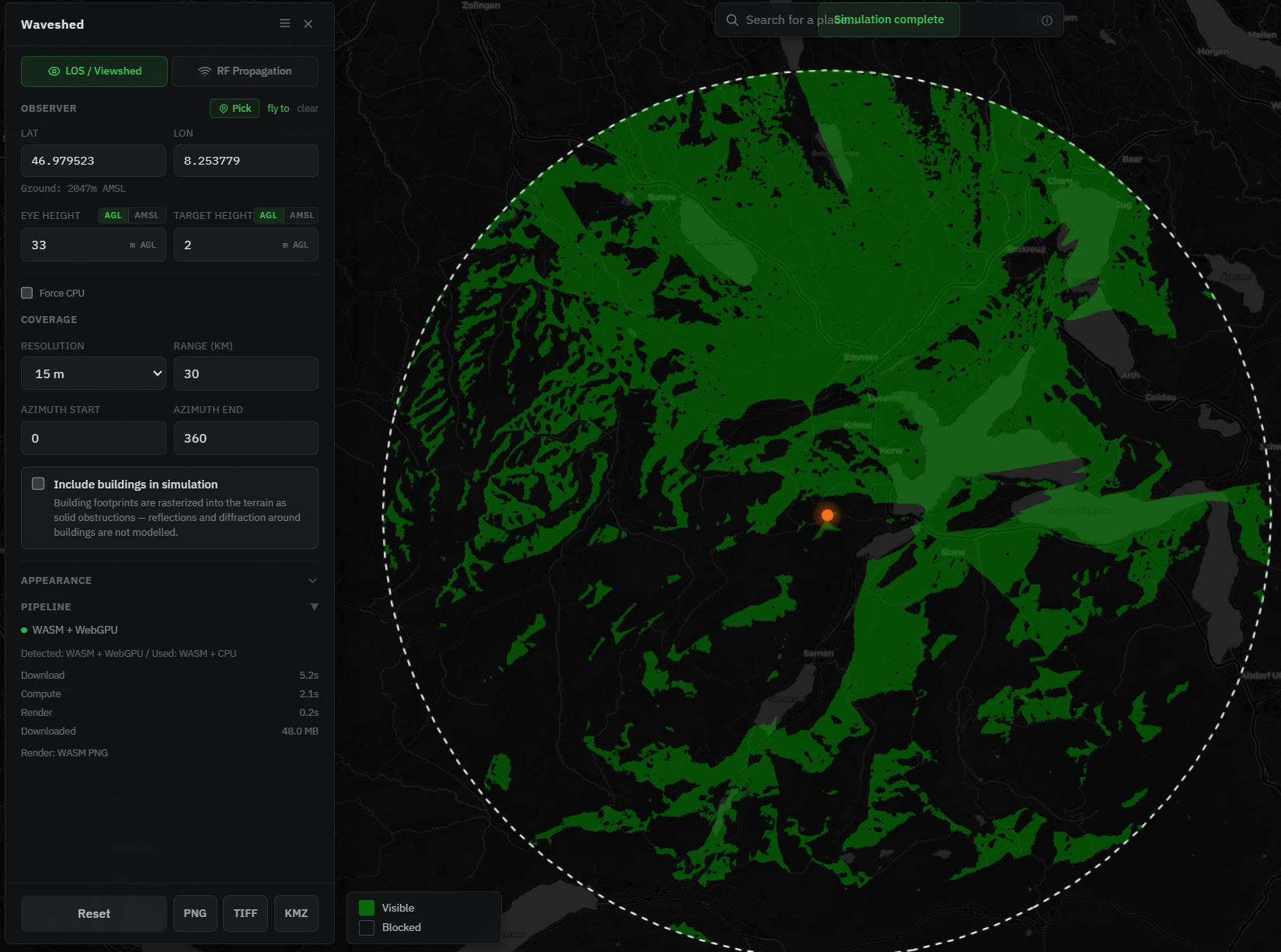
That flat map is the "shed": the catchment of everything visible from the summit, drawn by the surrounding ridges. If the word looks odd, that is its own story in why we called it Waveshed.
See it in 3D
This is where it gets fun for hikers. Switch the basemap to the 3D style and tilt the map: the viewshed drapes over the real terrain, so you can look out toward a far ridge and tell whether it is lit (in view) or shadowed (hidden). You can fly the scene with the keyboard, drop to eye level on the summit, and turn a full circle, which is about as close as you get to standing up there before you go.
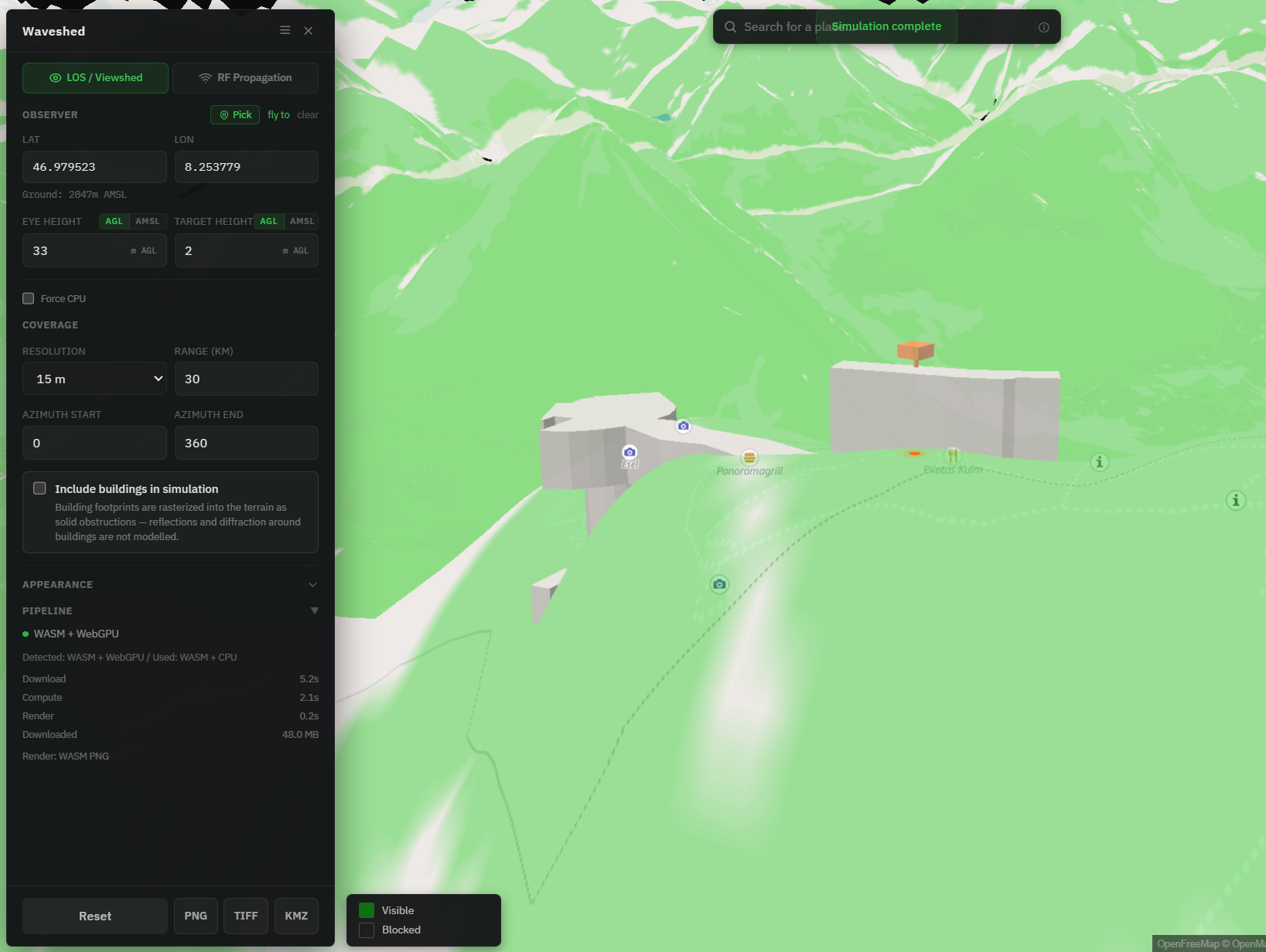
Seeing the shed in 3D makes the geometry obvious. The lit slopes fall away toward you, and the dark pockets are exactly the dead ground a flat map hides.
"Can I see that peak from here?"
For a specific question, two peaks and one sight line, use the elevation profile. Measure from your summit to the one you are curious about, and the profile draws the ground between them with the straight sight line on top. If the terrain stays below the line, the peak is visible. If a ridge pokes through, it is hidden, no matter how close it looks.
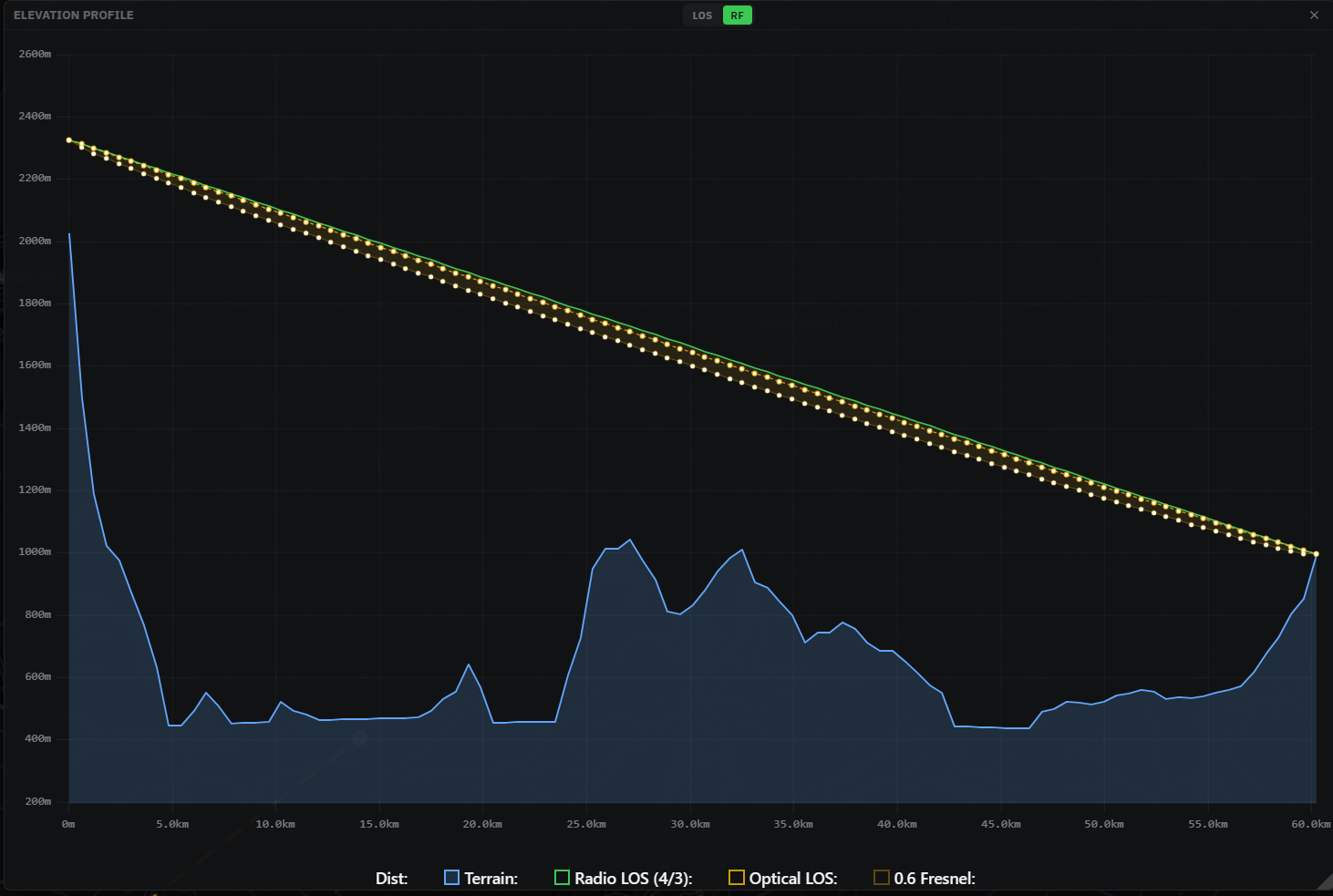
It is a quick way to settle "can you really see that summit from there" before you carry a long lens up.
A couple of things to know
- Eye height matters more on a ridge than a summit. On a broad top a metre or two changes little, but on a knife edge it can change a lot. Set it to your standing height for an honest result.
- The horizon is real. The viewshed accounts for the curve of the Earth, so a distant peak can sit just below the horizon even with clear ground in between.
- It is the bare-earth view. Terrain comes from global data of roughly 30 m, and individual trees and foliage are not modelled, so treat dense forest and fine detail with caution. There is more in Accuracy & data sources.
Will my radio reach, too?
If you carry a handheld, whether that is PMR, amateur radio, or a SOTA activation, the same terrain that shapes your view shapes your signal. Switch to RF mode and the map estimates where a handheld is likely to reach, along the trail or down into a valley. The two questions are close cousins, and we pulled them apart in a viewshed for radio: LOS vs RF.
Plan your next summit
Pick a peak, drop a point, and run a viewshed. Then tilt it into 3D and look around. It is free and runs in the browser.