How accurate is browser terrain, really?
Updated 16 October 2026: Waveshed’s terrain now comes from Mapterhorn instead of the AWS Terrain Tiles. Alpine summits sit within about 20 m of their true position, where the old tiles put them up to 270 m off. Short answer: it depends where you point it. Waveshed reads elevation from a global composite. Most of the world resolves at about 30 m (Copernicus GLO-30), but Germany, Austria, Norway and Britain are nearer 1 m, Switzerland 2 m and the United States about 10 m. Several other countries add fine data of their own. It models the bare ground, so it is a strong planning estimate, not survey grade. Here is what that really means, and how to go finer when you need to.
Where does the elevation come from?
Elevation comes from Mapterhorn, an open-data project that publishes terrain tiles for the whole world. Waveshed reads the Terrarium-encoded tiles straight in your browser, decoding a height from the colour of each pixel. Mapterhorn stitches open elevation data together by region. Copernicus GLO-30 is the backbone at about 30 m worldwide, and several countries drop much finer national data in on top, from 10 m down to 0.5 m. Japan, and any tile Mapterhorn cannot serve, comes from the AWS Terrain Tiles (NASA SRTM, about 30 m). The full source list is on the accuracy page.
Each pixel carries its height in the colour channels: height = R × 256 + G + B/256 − 32768 metres. The format resolves to about four millimetres, so the encoding is never the weak link. Accuracy is about the spacing between real samples, and that spacing changes with where you are.
How good is it where you are?
Because Mapterhorn layers national datasets over the Copernicus GLO-30 backbone, the resolution you actually get depends on the country under your point:
- Germany, Austria, Norway and Great Britain sit at about 1 m, from national lidar.
- Switzerland is 2 m everywhere from swissALTI3D, and 0.5 m in parts.
- Most other European countries are covered by national models as well. France, for example, is 5 m, and 1 m in parts.
- The United States runs at about 10 m, dropping to 1 m in parts, via USGS 3DEP.
- Parts of Australia and New Zealand come in at 5 m and 1 m respectively.
- Most of the rest of the world is the 30 m Copernicus GLO-30 baseline, the far north included. Japan is about 30 m too, from the SRTM fallback.
In the browser, nothing gets finer than the tile grid at its finest zoom, which is around 3 m. So the honest ceiling is a couple of metres in the best-mapped countries, and about 30 m across most of the map. The full list of sources, country by country, is on the Mapterhorn attribution page.
What does "30 metres" actually mean?
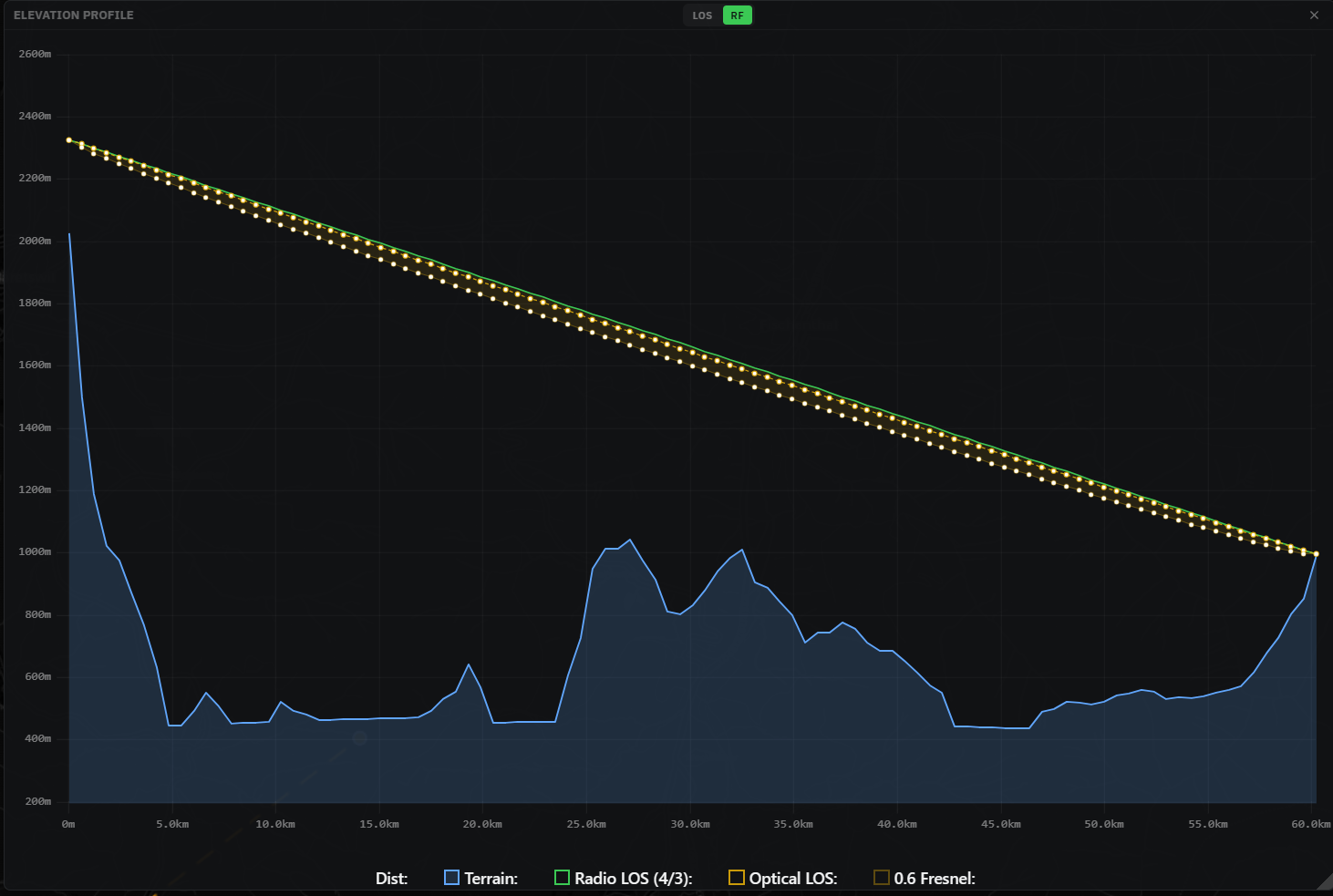
Where Copernicus GLO-30 is the source, and that is most of the world, 30 m is the spacing between real elevation samples. One value for every 30 m or so of ground. A rock face, a narrow gully, or a ridge thinner than a football pitch can fall between two samples and never show up at all. Add a few metres of vertical error on top, more on steep slopes, and you have the honest picture.
Then why can I choose 3 m?
Because the setting is the analysis resolution, not the resolution of the data. It tells Waveshed how fine a grid to sample onto, and it can never add detail the source lacks. Over Britain a fine grid is backed by real 1 m data. Over GLO-30 ground the same setting just interpolates between 30 m samples, giving a smoother picture rather than more truth. Match the setting to the data under your point. How resolution, range and speed pull against each other is its own trade-off.
What the terrain leaves out
Waveshed works on the bare ground. Buildings, trees, foliage and street clutter are not part of the model. Neither are reflections, multipath, or weather effects like ducting. In towns and forests that can make coverage look optimistic. You can add building footprints by hand as solid obstructions, which is covered in working with buildings.
Need finer than the tiles? Bring your own terrain.
The browser is tuned for instant, no-setup planning, so it lives with the global tiles. When you need better, the planned QGIS plugin runs the same Aether engine on any elevation layer QGIS can load. That means national LIDAR, agency DEMs, or your own drone or survey data, down to a metre or two and finer. Same propagation model, your terrain, no global ceiling. It is on the roadmap rather than live yet.
So how far should you trust a result?
Trust it most where the ground is well mapped and terrain-limited, so open mountains, valleys and ridge lines, and above all in the countries with fine national data. Trust it least in the city, in dense forest, and on the last hundred metres into one specific building. Use it to compare sites, pick a mast height and rule out blocked paths. For which model answers which question, we pulled LOS and RF apart in a viewshed for radio. Then verify a critical link in the field.
Try it on ground you know
Pick a summit or a hill you know well, drop a point, and look at the profile. You will see straight away what the model catches and what it rounds off. It is free and runs in the browser. If summits are your thing, there is a whole guide on viewsheds for hikers.